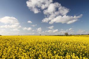
Environment

Oxfordshire has a rich natural environment with:
- Four National Nature Reserves
- More than one hundred Sites of Special Scientific Interest
- Seven Special Areas of Conservation, many local nature reserves
- 200 conservation areas across Oxfordshire
- Three Areas of Outstanding Natural Beauty in the county: the Chiltern Hills, the Cotswolds and the North Wessex Downs
DOWNLOAD and EXPLORE
Climate vulnerability
- Climate vulnerability assessment Oxfordshire April 2024
- Extreme temperatures and rainfall in Oxfordshire April 2024
Climate and health
Energy transition and carbon emissions
- Bitesize report on carbon emissions in Oxfordshire (Nov 2021)
- UK Local authority and regional carbon dioxide emissions, latest statistics on greenhouse gas emissions (Department for Business, Energy and Industrial Strategy)
- Oxfordshire's Energy Transition storymap (exploring data from the Pathways to Zero Carbon Oxfordshire report and Project Leo)
- Place-based carbon calculator showing average carbon footprint for small areas
- Carbon dioxide emissions and woodland coverage where you live (ONS)
Treescapes and Green Infrastucture
- Treescapes project Web App maps
- Treescapes Story map
- Green infrastructure and access to nature information resources (Oxfordshire County Council)
- Green Infrastructure mapping tool (Natural England)
Air quality
- Air quality website showing the latest air pollution levels from monitoring sites across Oxfordshire
Radon
- Radon risk to health (UK Health Security Agency)
- Interactive radon map (UK Health Security Agency)
- Information about radon from West Oxfordshire District Council
Contaminated Land
- Land is legally defined as "contaminated land" where substances are causing significant harm to people, property or protected species, significant pollution of surface waters or groundwater or harm to people as a result of radioactivity.
- Local information on contaminated land is available from Local Authorities Contaminated Land Registers:
- Cherwell Contaminated Land Strategy
- Oxford City Contaminated Land Register
- South Oxfordshire advice and entries on district register
- Vale of White Horse advice on contaminated land
- West Oxfordshire Contaminated Land Register
Drinking water quality
- Thames Water online tool to check your local drinking water quality
- Drinking Water annual report 2021 (Drinking Water Inspectorate)
- Advice on private water supplies is available from Cherwell, South Oxfordshire, Vale of White Horse, West Oxfordshire
Rivers and other watercourse quality and flooding
- The Environment Agency oversees the water quality of water courses.
- Thames Water river health data
- Oxfordshire flood risk toolkit (Oxfordshire County Council)
Nature and Biodiversity
- Thames Valley Environmental Records Centre for data about species, habitats and wildlife sites in Berkshire and Oxfordshire
- Wild Oxfordshire nature conservation charity
